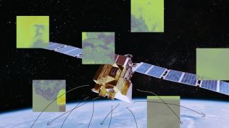
Google just joined a project to identify methane leaks from space — potentially helping plug leaks of the potent greenhouse gas, which is responsible for one-seventh of human greenhouse emissions.
The challenge: Carbon emissions are bad for the climate, but there’s usually a positive trade off, like electricity or transportation.
Emissions of the potent greenhouse gas methane, on the other hand, are often released accidentally by the fossil fuel industry, through leaky natural gas pipes or storage tanks, for example. That’s not only wasteful, it’s even worse for the climate than burning the natural gas for power.
Pinpointing methane leaks using airplane surveys and ground-based samples has been a laborious process.
If we can find and repair these leaks, it could have an outsized impact on climate change, as methane emissions cause 80 times more warming, pound for pound, than carbon emissions in the first 20 years after they’re released.
Pinpointing leaks using airplane surveys and ground-based samples has been a laborious process, though. Satellites are making it easier, as they can look for methane leaks over larger areas, but as the area they can survey increases, their sensitivity typically goes down.
The idea: In 2018, the Environmental Defense Fund (EDF) announced plans to build and deploy “MethaneSAT,” a methane-detecting satellite that would be able to measure leaks with high precision, while also being able to survey large areas of land.
“MethaneSAT is the first satellite of its kind to offer the ‘best of both worlds’ in both spatial coverage and sensitivity to emissions,” Patrick Barker, an analyst at energy research and consultancy firm Wood Mackenzie, told the Financial Times.
What’s new? With the deployment of MethaneSAT now less than a month away, the EDF has landed a major new partner on the project: Google.
On February 14, the tech giant announced that Google Cloud will provide the processing power for MethaneSAT’s detection algorithms. Google will also use its AI tech to identify oil and gas infrastructure in satellite imagery. Maps of that infrastructure can then be compared to the MethaneSAT data to identify the precise sources of methane leaks.
The plan is to make all of this information available on Google Earth Engine, an environmental monitoring platform that is available to researchers, non-profits, and journalists for free.
“Once those maps are lined up, we expect people will be able to have a far better understanding of the types of machinery that contribute most to methane leaks,” Yael Maguire, VP of geo-sustainability at Google, told MIT Technology Review.
“We think this is a moonshot.”
Yael Maguire
Looking ahead: Identifying methane leaks won’t stop their impact on climate change — action must be taken to fix the leaks, and data alone may not be enough to make that happen.
If fossil fuel companies aren’t willing to fix their leaks, it may be up to governments to put pressure on them, but MethaneSAT’s detailed information will make it easier for them to identify and prioritize the worst offenders.
“We think this is a moonshot,” Maguire told the FT. “We have a lot of optimism that we can help all of the scientists, researchers, public sector institutions, and the oil and gas industry build the cleaner future that we all want.”
We’d love to hear from you! If you have a comment about this article or if you have a tip for a future Freethink story, please email us at [email protected].


